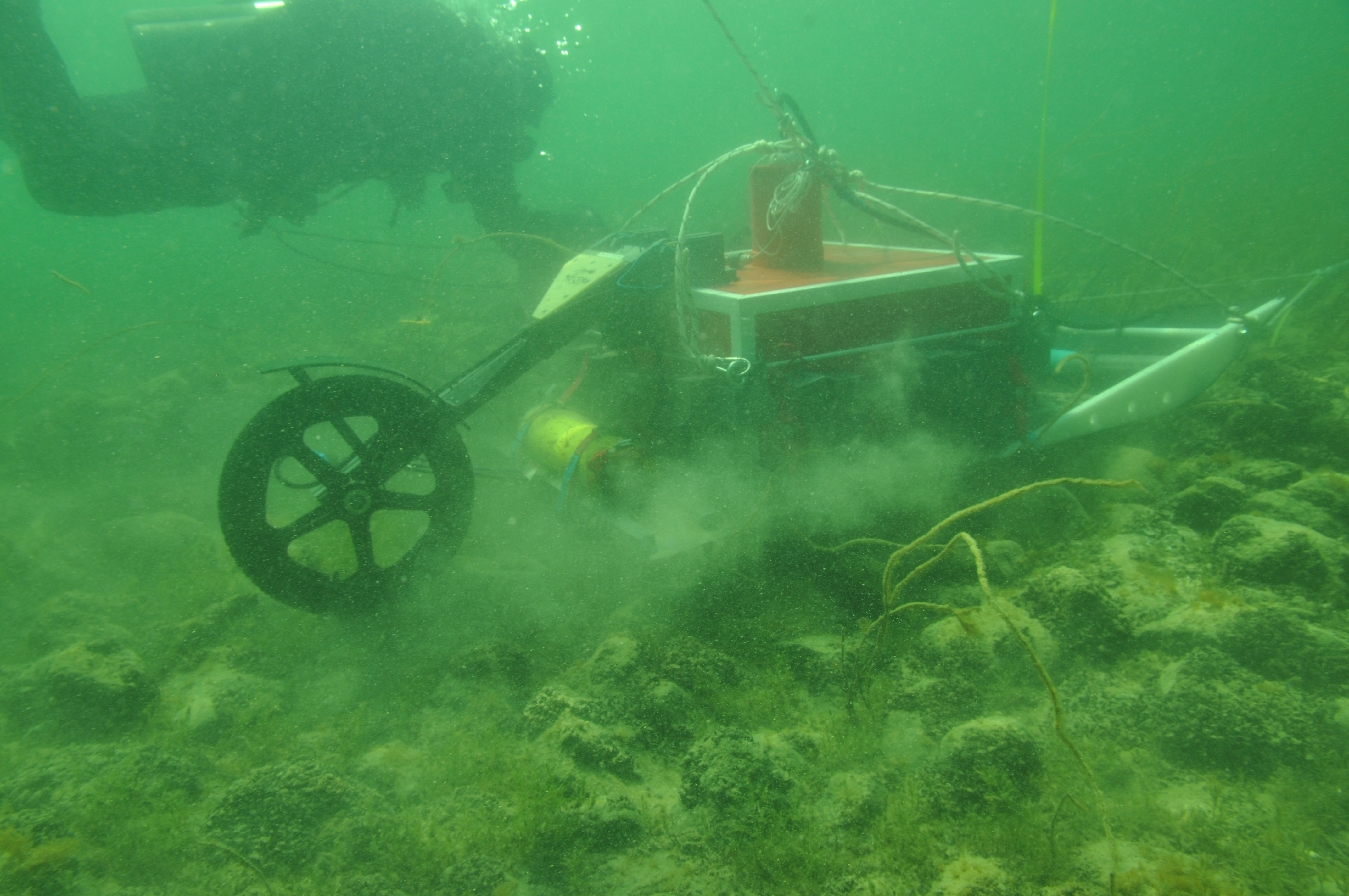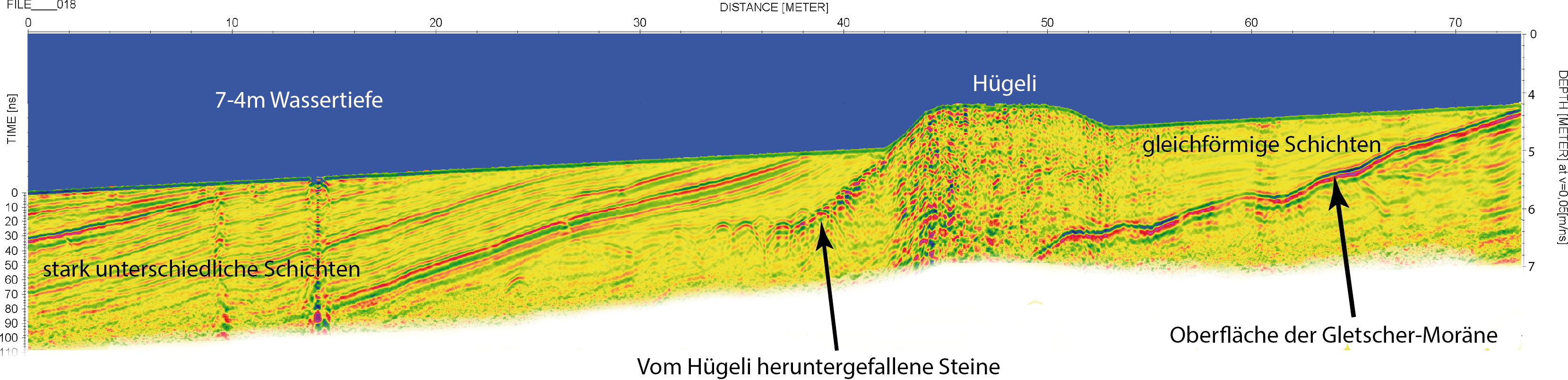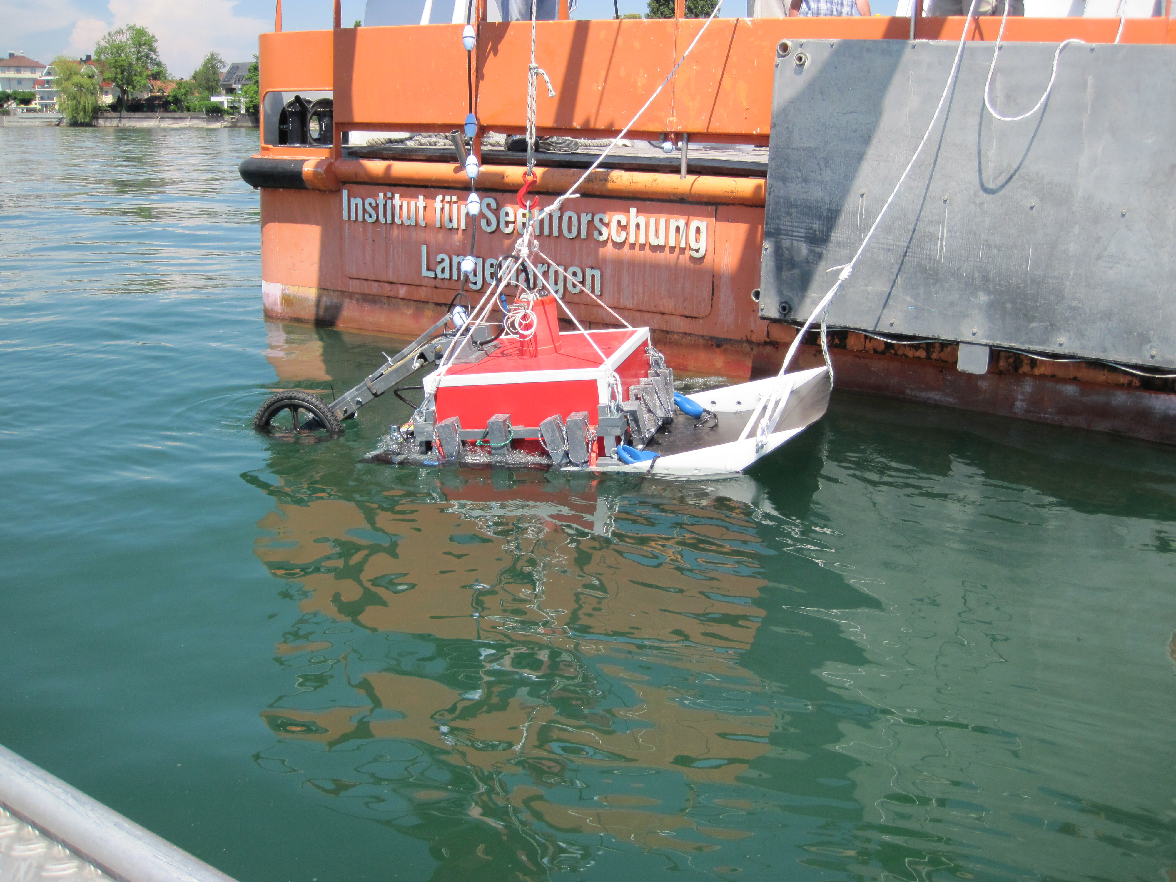
As part of the EU project 'HyMoBioStrategie', in cooperation with the Institute for Lake Research in Langenargen (Lake Constance), a georadar system from GSSI was modified so that it can be used underwater, currently up to 10m depth. The further development is currently underway. This made it possible for the first time in the world to examine lacustrine sediments up to 3m below the sea floor with high resolution. These structural analyzes led to a completely new picture of lacustrine flow dynamics and the resulting sediment distribution processes. Archaeological sites under water could also be examined with this system and, in the case of the “Hügelis” on the Swiss shores of Lake Constance, led to sensational findings with a corresponding media response.
Dr. Jens Hornung
Contact
hornung@geo.tu-...
work +49 6151 16-20632